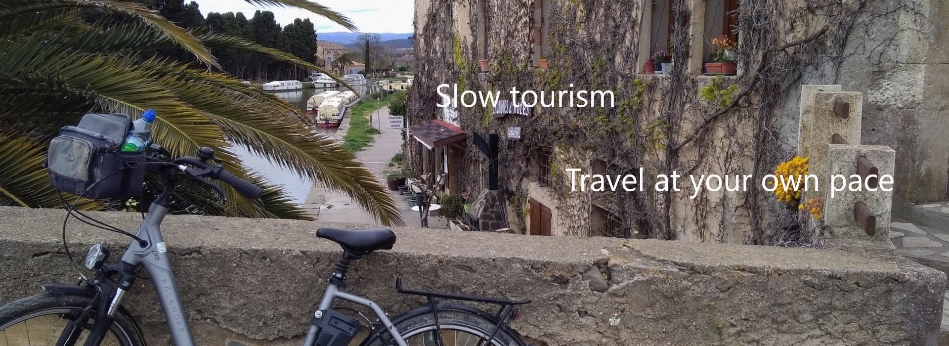
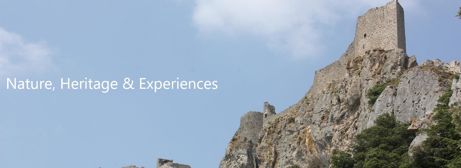
Biking along the Canal du Midi
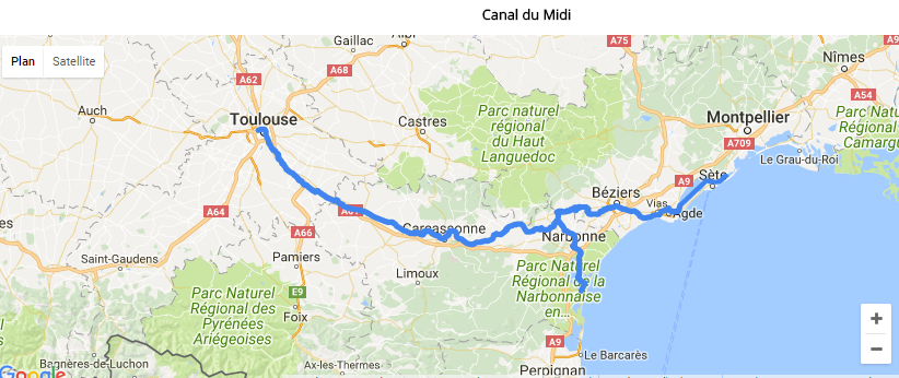
The Canal du Midi runs for more than 250 km from Toulouse to the Mediterranean Sea. It has been an economic issue since ancient times: it was really crucial to be able to avoid long crossings of the Mediterranean and the Atlantic Ocean, beset by danger and frequented by pirates. But the canal only came into play late in the story.
The Canal des deux mers (canal of the two seas) is the name given to the waterway formed by the Canal du Midi (from Sète to Toulouse) and the canal running alongside the Garonne (from Toulouse to Castets-en-Dorthe, 193 km), all linking the Mediterranean to the Atlantic Ocean.
In 1998, the Inter-Ministerial Committee for Regional Planning and Development decided to establish a national network of greenways. The Canal du Midi then became a part of this network of bikeways.
Its designer - Pierre-Paul Riquet - succeeded in conveying water from the Black Mountain to the highest point of the canal, Seuil de Naurouze. The Saint-Ferréol Lake is the canal's most important reservoir; a dam 786 m long and 149 high contains the lake's waters. At the foot of the falls, there is a museum about the canal.
The building of the canal involved more than 12,000 workers, masons, blacksmiths and stonecutters; it took 15 years, from 1666 to 1681, during the reign of Louis XIV, to build 63 locks, 126 bridges, 7 canal bridges, 6 dams and the canal tunnel.
Whilst the construction of the canal itself was revolutionary, so were the working conditions: Riquet organized free recruitment through individual contracts, paid his employees well and gave them unprecedented benefits (no work on rainy days, paid Sundays and holidays, sick leave).
Initially named "the Royal Languedoc Canal", the canal was renamed by the revolutionaries in 1789: the "Canal du Midi".
Inaugurated in 1681, the Canal du Midi was then completed by Marshal Vauban, who was responsible for waterways. Superb canal bridges and aqueducts enabled boats to cross rivers safely.
One tip: take your time, visit the villages along the way, take in the historic sites of the Canal du Midi, like the village of Le Somail, the Malpas tunnel or the 9 locks of Fonseranes, at Béziers.
The greenways and cycle paths of the South:
The Canal des deux mers (canal of the two seas) is the name given to the waterway formed by the Canal du Midi (from Sète to Toulouse) and the canal running alongside the Garonne (from Toulouse to Castets-en-Dorthe, 193 km), all linking the Mediterranean to the Atlantic Ocean.
In 1998, the Inter-Ministerial Committee for Regional Planning and Development decided to establish a national network of greenways. The Canal du Midi then became a part of this network of bikeways.
The Canal du Midi
This is one of the oldest European canals still in use. The canal, which was declared a World Heritage Site by UNESCO in 1996, was considered at the time to be the greatest construction project of the 17th century and a marvelous work of civil engineering: it revolutionized river transport in the Midi (transport of goods, passengers and postal mail).Its designer - Pierre-Paul Riquet - succeeded in conveying water from the Black Mountain to the highest point of the canal, Seuil de Naurouze. The Saint-Ferréol Lake is the canal's most important reservoir; a dam 786 m long and 149 high contains the lake's waters. At the foot of the falls, there is a museum about the canal.
The building of the canal involved more than 12,000 workers, masons, blacksmiths and stonecutters; it took 15 years, from 1666 to 1681, during the reign of Louis XIV, to build 63 locks, 126 bridges, 7 canal bridges, 6 dams and the canal tunnel.
Whilst the construction of the canal itself was revolutionary, so were the working conditions: Riquet organized free recruitment through individual contracts, paid his employees well and gave them unprecedented benefits (no work on rainy days, paid Sundays and holidays, sick leave).
Initially named "the Royal Languedoc Canal", the canal was renamed by the revolutionaries in 1789: the "Canal du Midi".
Inaugurated in 1681, the Canal du Midi was then completed by Marshal Vauban, who was responsible for waterways. Superb canal bridges and aqueducts enabled boats to cross rivers safely.
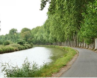
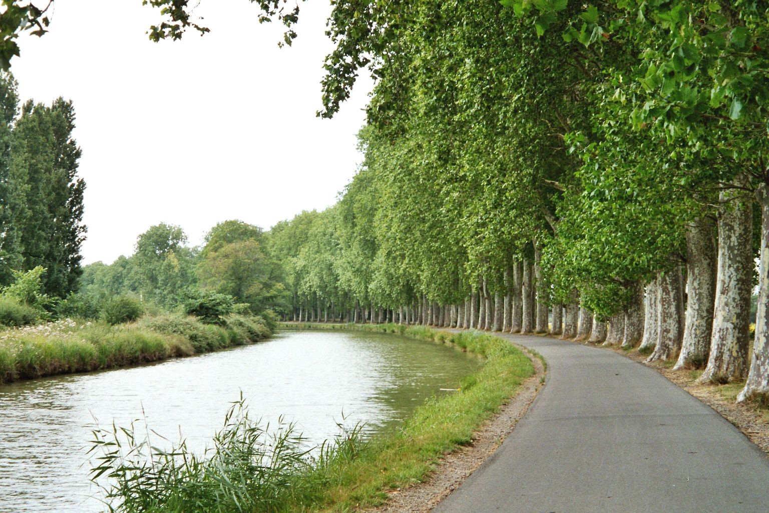
Greenways
The Canal du Midi greenways were created from former towpaths and are reserved for non-motorized users (pedestrians, cyclists, rollerbladers, scooters ...): they offer cyclists a safe route, ideal for adults and children, and quite flat. Not only for athletes!One tip: take your time, visit the villages along the way, take in the historic sites of the Canal du Midi, like the village of Le Somail, the Malpas tunnel or the 9 locks of Fonseranes, at Béziers.
The greenways and cycle paths of the South:
- Toulouse - Castets en Dorthe / Garonne Lateral Canal (199 km)
- Toulouse - Port Lauragais / Canal du Midi (49km)
- Seuil de Naurouze - Saint Ferréol Dam (33km)
- Saint Ferréol - Alzeau inlet /excursion to the Black Mountain (64 km)
- Port-Lauragais - Castelnaudary (16 km)
- Castelnaudary - Saint-Papoul / excursion to Saint Papoul Abbey (22 km)
- Castelnaudary - Carcassone (40 km)
- Carcassone - Homps (40 km)
- Homps – Le Somail / excursion to Minerve (36 km)
- Homps - Le Somail (20 km)
- Canal de jonction - Port-la-Nouvelle (37 km)
- Mandirac - Saint-Pierre-sur-Mer / excursion to Saint-Pierre-sur-Mer (19 km)
- Le Somail - Béziers (41 km)
- Béziers - Etang de Thau (les Onglous) (33 km)
- Onglous - Sète /Excursion to Sète (20 km)
- Narbonne - Port la Nouvelle / Canal de la Robine (23 km)
- Lake de Lenclas - Lake de Saint Ferréol / Rigole de la Plaine (14.2 km)